
Thank you for supporting this site ❤️
Make a donation
Make a donation
Berzée topographic map
Click on the map to display elevation.
Thank you for supporting this site ❤️
Make a donation
Make a donation
About this map
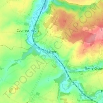
Name: Berzée topographic map, elevation, terrain.
Location: Berzée, Walcourt, Philippeville, Namen, Wallonië, 5651, België (50.26924 4.38122 50.30924 4.42122)
Average elevation: 182 m
Minimum elevation: 142 m
Maximum elevation: 237 m
Thank you for supporting this site ❤️
Make a donation
Make a donation
Other topographic maps
Click on a map to view its topography, its elevation and its terrain.