
Thank you for supporting this site ❤️
Make a donation
Make a donation
Buford topographic map
Click on the map to display elevation.
Thank you for supporting this site ❤️
Make a donation
Make a donation
About this map
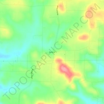
Name: Buford topographic map, elevation, terrain.
Location: Buford, Baxter County, Arkansas, United States (36.22562 -92.44849 36.26562 -92.40849)
Average elevation: 225 m
Minimum elevation: 182 m
Maximum elevation: 291 m
Thank you for supporting this site ❤️
Make a donation
Make a donation
Other topographic maps
Click on a map to view its topography, its elevation and its terrain.