
Thank you for supporting this site ❤️
Make a donation
Make a donation
Rock Garden topographic map
Click on the map to display elevation.
Thank you for supporting this site ❤️
Make a donation
Make a donation
About this map
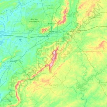
Name: Rock Garden topographic map, elevation, terrain.
Location: Rock Garden, Cleburne County, Alabama, United States (33.16205 -86.13469 33.80205 -85.49469)
Average elevation: 268 m
Minimum elevation: 137 m
Maximum elevation: 723 m
Thank you for supporting this site ❤️
Make a donation
Make a donation
Other topographic maps
Click on a map to view its topography, its elevation and its terrain.