
Make a donation
Cipreses topographic map
Click on the map to display elevation.
Make a donation
About this map
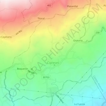
Name: Cipreses topographic map, elevation, terrain.
Location: Cipreses, Oreamuno, Cartago Province, 30704, Costa Rica (9.87682 -83.86133 9.91208 -83.82251)
Average elevation: 1,775 m
Minimum elevation: 1,486 m
Maximum elevation: 2,190 m
Make a donation
Other topographic maps
Click on a map to view its topography, its elevation and its terrain.
Irazú Volcano
Costa Rica > Oreamuno > Santa Rosa
The Irazú volcano is a complex volcanic shield. It is the highest active volcano in Costa Rica, and has an area of 500 km2 (190 sq mi). It has an irregular subconic shape, and temperatures at its summit vary between 3 and 17 °C (37 and 63 °F), with a record low of −3 °C(26.6 °F) and a record high of…
Average elevation: 3,114 m