
Thank you for supporting this site ❤️
Make a donation
Make a donation
Sudlon II topographic map
Click on the map to display elevation.
Thank you for supporting this site ❤️
Make a donation
Make a donation
About this map
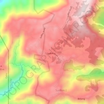
Name: Sudlon II topographic map, elevation, terrain.
Location: Sudlon II, Cebu City, Central Visayas, Philippines (10.35958 123.76467 10.39958 123.80467)
Average elevation: 634 m
Minimum elevation: 232 m
Maximum elevation: 843 m
Thank you for supporting this site ❤️
Make a donation
Make a donation
Other topographic maps
Click on a map to view its topography, its elevation and its terrain.