
Make a donation
Terre Du Lac topographic map
Click on the map to display elevation.
Make a donation
About this map
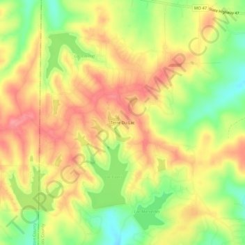
Name: Terre Du Lac topographic map, elevation, terrain.
Location: Terre Du Lac, Saint Francois County, Missouri, United States (37.89172 -90.64541 37.93172 -90.60541)
Average elevation: 280 m
Minimum elevation: 232 m
Maximum elevation: 315 m
Make a donation
Other topographic maps
Click on a map to view its topography, its elevation and its terrain.
Bonne Terre
United States > Missouri > Saint Francois County
Bonne Terre is part of the Southeast Missouri Lead District, an area of rolling hills of the Ozark Plateau with elevations up to 300 feet. The ground is mostly red clay over a base of limestone. The area contains the highest concentration of galena (lead(II) sulfide) in the world.
Average elevation: 253 m
St. Joe State Park
United States > Missouri > Saint Francois County > Park Hills
Average elevation: 293 m
Make a donation