
Thank you for supporting this site ❤️
Make a donation
Make a donation
Oakland topographic map
Click on the map to display elevation.
Thank you for supporting this site ❤️
Make a donation
Make a donation
About this map
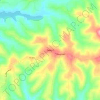
Name: Oakland topographic map, elevation, terrain.
Location: Oakland, Marion County, Arkansas, 72661, United States (36.44090 -92.59100 36.48090 -92.55100)
Average elevation: 259 m
Minimum elevation: 196 m
Maximum elevation: 343 m
Thank you for supporting this site ❤️
Make a donation
Make a donation
Other topographic maps
Click on a map to view its topography, its elevation and its terrain.