
Lancing topographic map
Click on the map to display elevation.
About this map
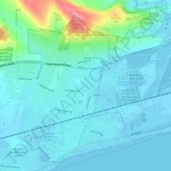
Name: Lancing topographic map, elevation, terrain.
Location: Lancing, Adur, West Sussex, England, United Kingdom (50.81610 -0.33722 50.85006 -0.28438)
Average elevation: 18 m
Minimum elevation: -3 m
Maximum elevation: 110 m
Other topographic maps
Click on a map to view its topography, its elevation and its terrain.