
Thank you for supporting this site ❤️
Make a donation
Make a donation
Long Mountain topographic map
Click on the map to display elevation.
Thank you for supporting this site ❤️
Make a donation
Make a donation
About this map
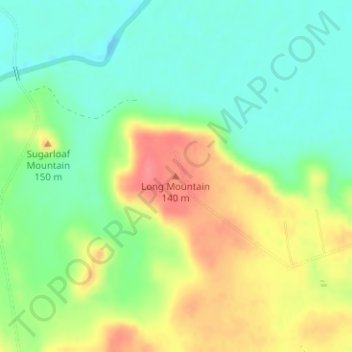
Name: Long Mountain topographic map, elevation, terrain.
Location: Long Mountain, Milam County, Texas, 77857, United States (30.81764 -96.73003 30.81774 -96.72993)
Average elevation: 105 m
Minimum elevation: 75 m
Maximum elevation: 147 m
Thank you for supporting this site ❤️
Make a donation
Make a donation
Other topographic maps
Click on a map to view its topography, its elevation and its terrain.