
Thank you for supporting this site ❤️
Make a donation
Make a donation
Le Breuil - Cervinia topographic map
Click on the map to display elevation.
Thank you for supporting this site ❤️
Make a donation
Make a donation
Le Breuil - Cervinia
The ski area is very large and guarantees good snow quality during the season, being at a high altitude (2,050 m to 3,500 m).
Thank you for supporting this site ❤️
Make a donation
Make a donation
About this map
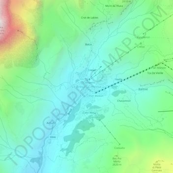
Name: Le Breuil - Cervinia topographic map, elevation, terrain.
Location: Le Breuil - Cervinia, Valtournenche, Aosta Valley, 11021, Italy (45.91560 7.61044 45.95560 7.65044)
Average elevation: 2,376 m
Minimum elevation: 1,914 m
Maximum elevation: 3,806 m
Thank you for supporting this site ❤️
Make a donation
Make a donation