
Thank you for supporting this site ❤️
Make a donation
Make a donation
Greer topographic map
Click on the map to display elevation.
Thank you for supporting this site ❤️
Make a donation
Make a donation
About this map
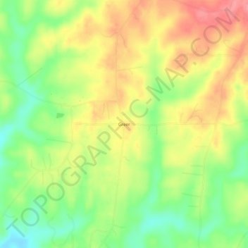
Name: Greer topographic map, elevation, terrain.
Location: Greer, Elmore County, Alabama, United States (32.66069 -86.17691 32.70069 -86.13691)
Average elevation: 150 m
Minimum elevation: 107 m
Maximum elevation: 191 m
Thank you for supporting this site ❤️
Make a donation
Make a donation
Other topographic maps
Click on a map to view its topography, its elevation and its terrain.