
Santol topographic map
Click on the map to display elevation.
About this map
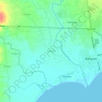
Name: Santol topographic map, elevation, terrain.
Location: Santol, Balayan, Batangas, Calabarzon, 4213, Philippines (13.92121 120.69328 13.96121 120.73328)
Average elevation: 15 m
Minimum elevation: 0 m
Maximum elevation: 67 m
Other topographic maps
Click on a map to view its topography, its elevation and its terrain.