
Thank you for supporting this site ❤️
Make a donation
Make a donation
San Juan Ridge topographic map
Click on the map to display elevation.
Thank you for supporting this site ❤️
Make a donation
Make a donation
About this map
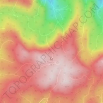
Name: San Juan Ridge topographic map, elevation, terrain.
Average elevation: 841 m
Minimum elevation: 519 m
Maximum elevation: 1,010 m
Thank you for supporting this site ❤️
Make a donation
Make a donation
Other topographic maps
Click on a map to view its topography, its elevation and its terrain.
Discovery Island
Canada > British Columbia > Capital Regional District > Juan de Fuca Electoral Area
Average elevation: 2 m
Arden Islet
Canada > British Columbia > Capital Regional District > Juan de Fuca Electoral Area
Average elevation: 50 m