
Thank you for supporting this site ❤️
Make a donation
Make a donation
Soegaon topographic map
Click on the map to display elevation.
Thank you for supporting this site ❤️
Make a donation
Make a donation
About this map
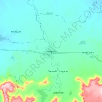
Name: Soegaon topographic map, elevation, terrain.
Location: Soegaon, Aurangabad, Maharashtra, 431120, India (20.55400 75.57795 20.63400 75.65795)
Average elevation: 399 m
Minimum elevation: 329 m
Maximum elevation: 679 m
Thank you for supporting this site ❤️
Make a donation
Make a donation
Other topographic maps
Click on a map to view its topography, its elevation and its terrain.