
Thank you for supporting this site ❤️
Make a donation
Make a donation
Porniguel topographic map
Click on the map to display elevation.
Thank you for supporting this site ❤️
Make a donation
Make a donation
About this map
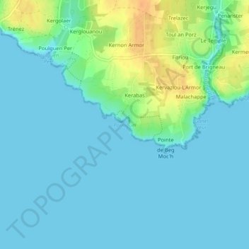
Name: Porniguel topographic map, elevation, terrain.
Location: Porniguel, Kerabas, France métropolitaine, 29350, France (47.77875 -3.68387 47.77885 -3.68377)
Average elevation: 8 m
Minimum elevation: 0 m
Maximum elevation: 35 m
Thank you for supporting this site ❤️
Make a donation
Make a donation