
Saint-Ouen-la-Rouërie topographic map
Interactive map
Click on the map to display elevation.
About this map
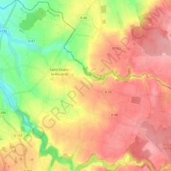
Name: Saint-Ouen-la-Rouërie topographic map, elevation, terrain.
Average elevation: 76 m
Minimum elevation: 10 m
Maximum elevation: 121 m
Other topographic maps
Click on a map to view its topography, its elevation and its terrain.
Antrain
France > Bretagne > Ille-et-Vilaine > Val-Couesnon
Antrain, Val-Couesnon, Fougères-Vitré, Ille-et-Vilaine, Bretagne, France métropolitaine, 35560, France
Average elevation: 50 m