
Thank you for supporting this site ❤️
Make a donation
Make a donation
Hellidon topographic map
Click on the map to display elevation.
Thank you for supporting this site ❤️
Make a donation
Make a donation
About this map
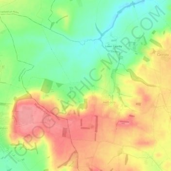
Name: Hellidon topographic map, elevation, terrain.
Location: Hellidon, West Northamptonshire, England, United Kingdom (52.20795 -1.28466 52.23863 -1.22503)
Average elevation: 159 m
Minimum elevation: 113 m
Maximum elevation: 205 m
Thank you for supporting this site ❤️
Make a donation
Make a donation