
Thank you for supporting this site ❤️
Make a donation
Make a donation
St. Lucas topographic map
Click on the map to display elevation.
Thank you for supporting this site ❤️
Make a donation
Make a donation
About this map
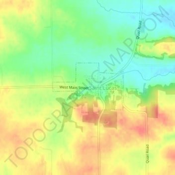
Name: St. Lucas topographic map, elevation, terrain.
Location: St. Lucas, Fayette County, Iowa, 52166, United States (43.06289 -91.94320 43.07053 -91.92823)
Average elevation: 338 m
Minimum elevation: 310 m
Maximum elevation: 364 m
Thank you for supporting this site ❤️
Make a donation
Make a donation
Other topographic maps
Click on a map to view its topography, its elevation and its terrain.