
Thank you for supporting this site ❤️
Make a donation
Make a donation
Deurne topographic map
Click on the map to display elevation.
Thank you for supporting this site ❤️
Make a donation
Make a donation
Deurne
Deurne ligt in de Zuiderkempen op een hoogte van 25-41 meter. Ten oosten van kom ligt het natuurreservaat Vallei van de Drie Beken.
Thank you for supporting this site ❤️
Make a donation
Make a donation
About this map
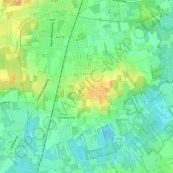
Name: Deurne topographic map, elevation, terrain.
Location: Deurne, Diest, Leuven, Vlaams-Brabant, België (51.02412 5.07796 51.04982 5.12487)
Average elevation: 25 m
Minimum elevation: 12 m
Maximum elevation: 43 m
Thank you for supporting this site ❤️
Make a donation
Make a donation
Other topographic maps
Click on a map to view its topography, its elevation and its terrain.