
Thank you for supporting this site ❤️
Make a donation
Make a donation
Freiburg Alps topographic map
Click on the map to display elevation.
Thank you for supporting this site ❤️
Make a donation
Make a donation
About this map
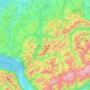
Name: Freiburg Alps topographic map, elevation, terrain.
Location: Freiburg Alps, Fribourg, Switzerland (46.31679 6.80875 46.79103 7.65458)
Average elevation: 1,174 m
Minimum elevation: 367 m
Maximum elevation: 3,220 m
Thank you for supporting this site ❤️
Make a donation
Make a donation
Other topographic maps
Click on a map to view its topography, its elevation and its terrain.