
Make a donation
Deißlingen topographic map
Click on the map to display elevation.
Make a donation
Deißlingen
The municipality (Gemeinde) of Deißlingen covers 32.15 square kilometers (12.41 sq mi) of the Rottweil district of Baden-Württemberg, which assigns Deißlingen to the metropolitan area of Villingen-Schwenningen, Tuttlingen, and Rottweil. Deißlingen is physically located in a transitional landscape between the muschelkalk-keuper plateaus of the Upper Gäu [de] to the north, the Swabian Jura to the east, and the Baar to the south. Elevation above sea level in the municipal area ranges from a high of 753 meters (2,470 ft) Normalnull (NN) at the border with Tuttlingen district to a low of 574 meters (1,883 ft) NN on the Neckar as it forms the border with Rottweil.
Make a donation
About this map
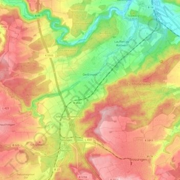
Name: Deißlingen topographic map, elevation, terrain.
Average elevation: 669 m
Minimum elevation: 563 m
Maximum elevation: 756 m
Make a donation