
Thank you for supporting this site ❤️
Make a donation
Make a donation
Ampelgading topographic map
Click on the map to display elevation.
Thank you for supporting this site ❤️
Make a donation
Make a donation
About this map
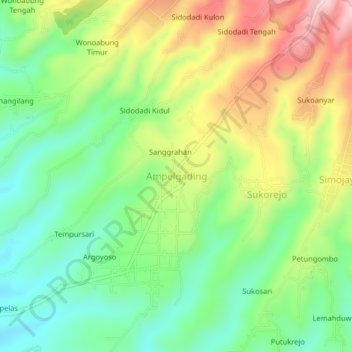
Name: Ampelgading topographic map, elevation, terrain.
Location: Ampelgading, Kabupaten Malang, Java, Indonesia (-8.22261 112.80988 -8.18261 112.84988)
Average elevation: 630 m
Minimum elevation: 511 m
Maximum elevation: 810 m
Thank you for supporting this site ❤️
Make a donation
Make a donation