
Thank you for supporting this site ❤️
Make a donation
Make a donation
Killarney topographic map
Click on the map to display elevation.
Thank you for supporting this site ❤️
Make a donation
Make a donation
About this map
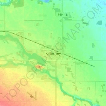
Name: Killarney topographic map, elevation, terrain.
Average elevation: 495 m
Minimum elevation: 475 m
Maximum elevation: 526 m
Thank you for supporting this site ❤️
Make a donation
Make a donation
Other topographic maps
Click on a map to view its topography, its elevation and its terrain.
Pelican Lake
Canada > Manitoba > Municipality of Killarney-Turtle Mountain
The lake is normally maintained at elevations between 411.5 and 412 metres (1,350 and 1,352 ft) above sea level during summer months. During the spring period, the lake may be raised temporarily to an elevation of 412.2 metres (1,352 ft). When the lake is low, water may be diverted from the Pembina River into…
Average elevation: 459 m