
Bacan Island topographic map
Interactive map
Click on the map to display elevation.
About this map
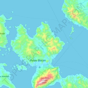
Name: Bacan Island topographic map, elevation, terrain.
Location: Bacan Island, North Maluku, Indonesia (-0.78464 127.21669 -0.14464 127.85669)
Average elevation: 125 m
Minimum elevation: -2 m
Maximum elevation: 2,057 m
Other topographic maps
Click on a map to view its topography, its elevation and its terrain.