
Thank you for supporting this site ❤️
Make a donation
Make a donation
Angler topographic map
Click on the map to display elevation.
Thank you for supporting this site ❤️
Make a donation
Make a donation
About this map
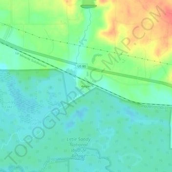
Name: Angler topographic map, elevation, terrain.
Location: Angler, Wood County, Texas, United States (32.57287 -95.27346 32.61287 -95.23346)
Average elevation: 101 m
Minimum elevation: 83 m
Maximum elevation: 139 m
Thank you for supporting this site ❤️
Make a donation
Make a donation
Other topographic maps
Click on a map to view its topography, its elevation and its terrain.