
Richmond City topographic map
Interactive map
Click on the map to display elevation.
About this map
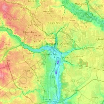
Name: Richmond City topographic map, elevation, terrain.
Location: Richmond City, Virginia, USA (37.44673 -77.60117 37.60245 -77.38530)
Average elevation: 49 m
Minimum elevation: -44 m
Maximum elevation: 104 m