
La Guillena topographic map
Interactive map
Click on the map to display elevation.
About this map
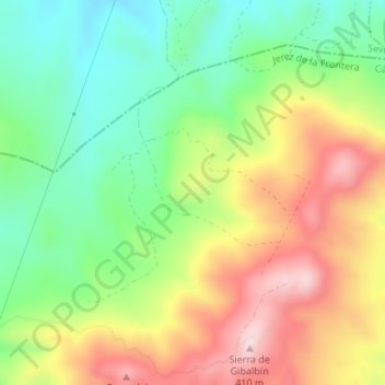
Name: La Guillena topographic map, elevation, terrain.
Average elevation: 237 m
Minimum elevation: 105 m
Maximum elevation: 406 m
Other topographic maps
Click on a map to view its topography, its elevation and its terrain.
Yacimiento de Hasta Regia
España > Andalucía > Jerez de la Frontera
Yacimiento de Hasta Regia, Calle José Antonio Granados César, Mesas de Asta, Jerez de la Frontera, Cádiz, Andalucía, 11590, España
Average elevation: 26 m