
Thank you for supporting this site ❤️
Make a donation
Make a donation
Vallåsen topographic map
Click on the map to display elevation.
Thank you for supporting this site ❤️
Make a donation
Make a donation
About this map
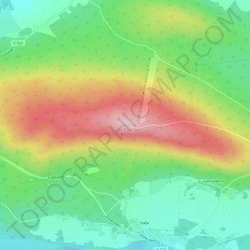
Name: Vallåsen topographic map, elevation, terrain.
Location: Vallåsen, Ljusdals kommun, Gävleborg County, 820 41, Sweden (61.81809 15.84175 61.81819 15.84185)
Average elevation: 227 m
Minimum elevation: 135 m
Maximum elevation: 360 m
Thank you for supporting this site ❤️
Make a donation
Make a donation
Other topographic maps
Click on a map to view its topography, its elevation and its terrain.
Thank you for supporting this site ❤️
Make a donation
Make a donation
Thank you for supporting this site ❤️
Make a donation
Make a donation
Thank you for supporting this site ❤️
Make a donation
Make a donation