
Thank you for supporting this site ❤️
Make a donation
Make a donation
Pulsberg topographic map
Click on the map to display elevation.
Thank you for supporting this site ❤️
Make a donation
Make a donation
About this map
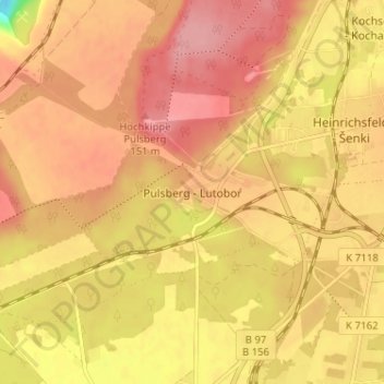
Name: Pulsberg topographic map, elevation, terrain.
Location: Pulsberg, Spremberg, Spree-Neiße, Brandenburg, Deutschland (51.53462 14.29450 51.57462 14.33450)
Average elevation: 126 m
Minimum elevation: 57 m
Maximum elevation: 158 m
Thank you for supporting this site ❤️
Make a donation
Make a donation
Other topographic maps
Click on a map to view its topography, its elevation and its terrain.