
Thank you for supporting this site ❤️
Make a donation
Make a donation
Mabel topographic map
Click on the map to display elevation.
Thank you for supporting this site ❤️
Make a donation
Make a donation
About this map
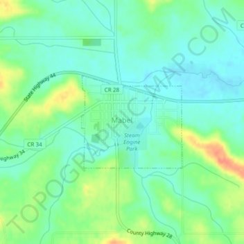
Name: Mabel topographic map, elevation, terrain.
Location: Mabel, Fillmore County, Minnesota, 55954, United States (43.51518 -91.77574 43.52543 -91.76035)
Average elevation: 350 m
Minimum elevation: 335 m
Maximum elevation: 381 m
Thank you for supporting this site ❤️
Make a donation
Make a donation
Other topographic maps
Click on a map to view its topography, its elevation and its terrain.