
Thank you for supporting this site ❤️
Make a donation
Make a donation
Ōtāne topographic map
Click on the map to display elevation.
Thank you for supporting this site ❤️
Make a donation
Make a donation
About this map
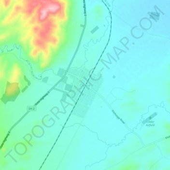
Name: Ōtāne topographic map, elevation, terrain.
Average elevation: 115 m
Minimum elevation: 76 m
Maximum elevation: 272 m
Thank you for supporting this site ❤️
Make a donation
Make a donation
Other topographic maps
Click on a map to view its topography, its elevation and its terrain.
Pōrangahau River
New Zealand > Hawke's Bay > Central Hawke's Bay District > Pōrangahau
Average elevation: 81 m