
Thank you for supporting this site ❤️
Make a donation
Make a donation
Les Epinettes topographic map
Click on the map to display elevation.
Thank you for supporting this site ❤️
Make a donation
Make a donation
About this map
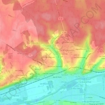
Name: Les Epinettes topographic map, elevation, terrain.
Average elevation: 105 m
Minimum elevation: 53 m
Maximum elevation: 136 m
Thank you for supporting this site ❤️
Make a donation
Make a donation
Other topographic maps
Click on a map to view its topography, its elevation and its terrain.
Montrichard
France > Centre-Val de Loire > Loir-et-Cher > Montrichard Val de Cher
Average elevation: 110 m