
Thank you for supporting this site ❤️
Make a donation
Make a donation
Eldfell topographic map
Click on the map to display elevation.
Thank you for supporting this site ❤️
Make a donation
Make a donation
About this map
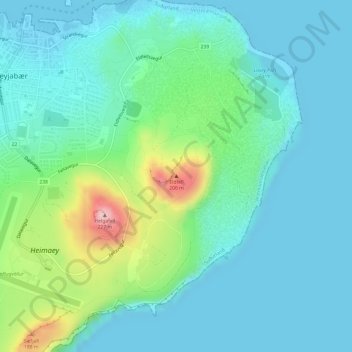
Name: Eldfell topographic map, elevation, terrain.
Location: Eldfell, Vestmannaeyjar, Southern Region, 900, Iceland (63.43227 -20.24733 63.43237 -20.24723)
Average elevation: 45 m
Minimum elevation: -2 m
Maximum elevation: 215 m
Thank you for supporting this site ❤️
Make a donation
Make a donation