
Thank you for supporting this site ❤️
Make a donation
Make a donation
Sunset Beach topographic map
Click on the map to display elevation.
Thank you for supporting this site ❤️
Make a donation
Make a donation
About this map
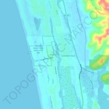
Name: Sunset Beach topographic map, elevation, terrain.
Location: Sunset Beach, Clatsop County, Oregon, United States (46.08122 -123.95042 46.12122 -123.91042)
Average elevation: 11 m
Minimum elevation: -3 m
Maximum elevation: 109 m
Thank you for supporting this site ❤️
Make a donation
Make a donation
Other topographic maps
Click on a map to view its topography, its elevation and its terrain.