
Brierfield topographic map
Click on the map to display elevation.
About this map
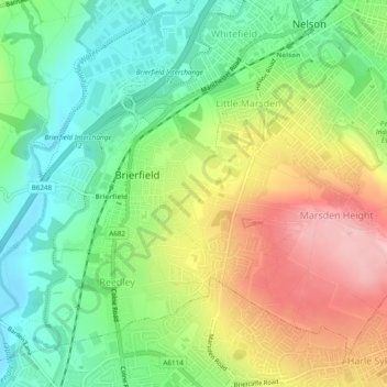
Name: Brierfield topographic map, elevation, terrain.
Average elevation: 161 m
Minimum elevation: 91 m
Maximum elevation: 270 m
Other topographic maps
Click on a map to view its topography, its elevation and its terrain.
Colne Water
United Kingdom > England > Lancashire > Borough of Pendle > Laneshaw Bridge
Average elevation: 202 m
Lad Law (Boulsworth Hill)
United Kingdom > England > Lancashire > Borough of Pendle
Average elevation: 409 m