
Pecos County topographic map
Interactive map
Click on the map to display elevation.
About this map
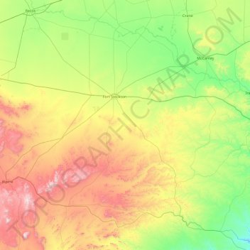
Name: Pecos County topographic map, elevation, terrain.
Location: Pecos County, Texas, United States (30.05270 -103.58471 31.37118 -101.76876)
Average elevation: 969 m
Minimum elevation: 540 m
Maximum elevation: 2,005 m
Other topographic maps
Click on a map to view its topography, its elevation and its terrain.