
Thank you for supporting this site ❤️
Make a donation
Make a donation
Aandhikhola topographic map
Click on the map to display elevation.
Thank you for supporting this site ❤️
Make a donation
Make a donation
About this map
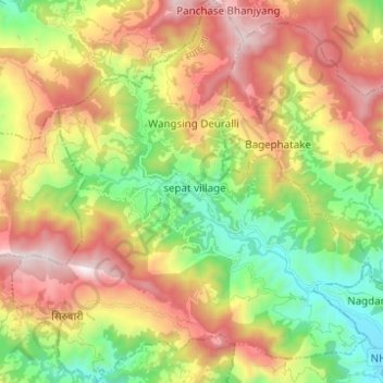
Name: Aandhikhola topographic map, elevation, terrain.
Location: Aandhikhola, Syangja, Gandaki Pradesh, Nepal (28.11245 83.74163 28.22117 83.85685)
Average elevation: 1,449 m
Minimum elevation: 824 m
Maximum elevation: 2,227 m
Thank you for supporting this site ❤️
Make a donation
Make a donation
Other topographic maps
Click on a map to view its topography, its elevation and its terrain.