
Make a donation
Remington Oaks topographic map
Click on the map to display elevation.
Make a donation
About this map
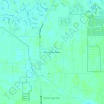
Name: Remington Oaks topographic map, elevation, terrain.
Location: Remington Oaks, Lee County, Florida, United States (26.65943 -81.74693 26.69943 -81.70693)
Average elevation: 6 m
Minimum elevation: 3 m
Maximum elevation: 9 m
Make a donation
Other topographic maps
Click on a map to view its topography, its elevation and its terrain.
Caloosahatchee River
United States > Florida > Lee County
Until late in the 19th century, the Caloosahatchee River was fed by a series of lakes starting from Lake Hicpochee, and including Lettuce Lake, Bonnet Lake and Flirt Lake. A waterfall and set of rapids at the lower end of Flirt Lake marked the beginning of the river. The rapids were close to 1 mile (1.6 km)…
Average elevation: 8 m
North Shore Park
United States > Florida > Lee County > North Fort Myers > Sunset North Condominiums
Average elevation: 1 m
Make a donation
Make a donation
Make a donation
Make a donation
Make a donation
Make a donation
Estero Bay Preserve State Park
United States > Florida > Lee County > Fort Myers Beach
Average elevation: 2 m
Calusa Land Trust and Nature Preserve of Pine Island
United States > Florida > Lee County > Cape Coral
Average elevation: 1 m