
Thank you for supporting this site ❤️
Make a donation
Make a donation
Green Bay topographic map
Click on the map to display elevation.
Thank you for supporting this site ❤️
Make a donation
Make a donation
About this map
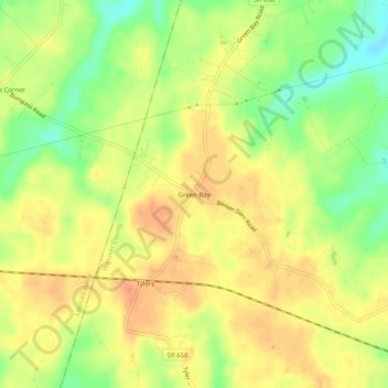
Name: Green Bay topographic map, elevation, terrain.
Location: Green Bay, Hanover County, Virginia, 23024, United States (37.94514 -77.71471 37.98514 -77.67471)
Average elevation: 90 m
Minimum elevation: 64 m
Maximum elevation: 106 m
Thank you for supporting this site ❤️
Make a donation
Make a donation
Other topographic maps
Click on a map to view its topography, its elevation and its terrain.