
Thank you for supporting this site ❤️
Make a donation
Make a donation
Tarbes topographic map
Click on the map to display elevation.
Thank you for supporting this site ❤️
Make a donation
Make a donation
Tarbes
In 1806 werd door Napoleon in Tarbes de nationale stoeterij (Haras de Tarbes) gesticht, met als doel zijn legers van voldoende paarden te voorzien. Hier werd in de loop van de 19e eeuw het anglo-arabisch paard gefokt. Op zijn hoogtepunt op het einde van de 19e eeuw had de stoeterij 150 fokhengsten.
Thank you for supporting this site ❤️
Make a donation
Make a donation
About this map
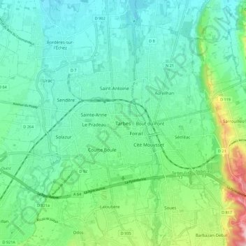
Name: Tarbes topographic map, elevation, terrain.
Average elevation: 319 m
Minimum elevation: 275 m
Maximum elevation: 458 m
Thank you for supporting this site ❤️
Make a donation
Make a donation