
Saint Andrew topographic map
Interactive map
Click on the map to display elevation.
About this map
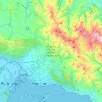
Name: Saint Andrew topographic map, elevation, terrain.
Location: Saint Andrew, Surrey County, Jamaica (17.92821 -76.88957 18.17983 -76.61731)
Average elevation: 434 m
Minimum elevation: -3 m
Maximum elevation: 2,010 m