
Fränkisch-Crumbach topographic map
Interactive map
Click on the map to display elevation.
About this map
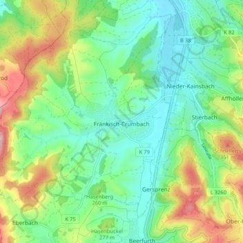
Name: Fränkisch-Crumbach topographic map, elevation, terrain.
Location: Fränkisch-Crumbach, Odenwaldkreis, Hessen, 64407, Deutschland (49.72280 8.79755 49.76842 8.87681)
Average elevation: 244 m
Minimum elevation: 171 m
Maximum elevation: 394 m
Other topographic maps
Click on a map to view its topography, its elevation and its terrain.
Güttersbach
Deutschland > Hessen > Odenwaldkreis
Güttersbach, Mossautal, Odenwaldkreis, Hessen, Deutschland
Average elevation: 384 m