
Thank you for supporting this site ❤️
Make a donation
Make a donation
Groß Flottbek topographic map
Click on the map to display elevation.
Thank you for supporting this site ❤️
Make a donation
Make a donation
About this map
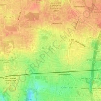
Name: Groß Flottbek topographic map, elevation, terrain.
Location: Groß Flottbek, Altona, Hamburg, 22607, Deutschland (53.55832 9.86373 53.57156 9.90042)
Average elevation: 32 m
Minimum elevation: 3 m
Maximum elevation: 47 m
Thank you for supporting this site ❤️
Make a donation
Make a donation
Other topographic maps
Click on a map to view its topography, its elevation and its terrain.