
Thank you for supporting this site ❤️
Make a donation
Make a donation
Taşlıca topographic map
Click on the map to display elevation.
Thank you for supporting this site ❤️
Make a donation
Make a donation
About this map
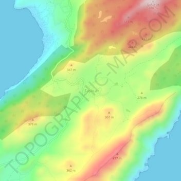
Name: Taşlıca topographic map, elevation, terrain.
Location: Taşlıca, Marmaris, Muğla, Aegean Region, Turkey (36.61264 28.08880 36.65264 28.12880)
Average elevation: 233 m
Minimum elevation: -5 m
Maximum elevation: 589 m
Thank you for supporting this site ❤️
Make a donation
Make a donation