
Albany County topographic map
Interactive map
Click on the map to display elevation.
About this map
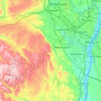
Name: Albany County topographic map, elevation, terrain.
Location: Albany County, New York, United States (42.40713 -74.26486 42.82258 -73.67676)
Average elevation: 230 m
Minimum elevation: -3 m
Maximum elevation: 697 m