
Thank you for supporting this site ❤️
Make a donation
Make a donation
Klivinge topographic map
Click on the map to display elevation.
Thank you for supporting this site ❤️
Make a donation
Make a donation
About this map
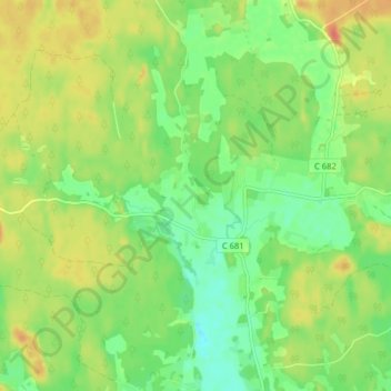
Name: Klivinge topographic map, elevation, terrain.
Location: Klivinge, Uppsala kommun, Provinz Uppsala, Schweden (60.00143 17.82714 60.04143 17.86714)
Average elevation: 37 m
Minimum elevation: 15 m
Maximum elevation: 63 m
Thank you for supporting this site ❤️
Make a donation
Make a donation
Other topographic maps
Click on a map to view its topography, its elevation and its terrain.