
Thank you for supporting this site ❤️
Make a donation
Make a donation
Lles de Cerdanya topographic map
Click on the map to display elevation.
Thank you for supporting this site ❤️
Make a donation
Make a donation
About this map
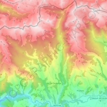
Name: Lles de Cerdanya topographic map, elevation, terrain.
Location: Lles de Cerdanya, Cerdanya, Lleida, Catalonia, 25726, Spain (42.35829 1.58120 42.50270 1.73021)
Average elevation: 1,903 m
Minimum elevation: 802 m
Maximum elevation: 2,907 m
Thank you for supporting this site ❤️
Make a donation
Make a donation
Other topographic maps
Click on a map to view its topography, its elevation and its terrain.