
Thank you for supporting this site ❤️
Make a donation
Make a donation
Dhorpatan topographic map
Click on the map to display elevation.
Thank you for supporting this site ❤️
Make a donation
Make a donation
About this map
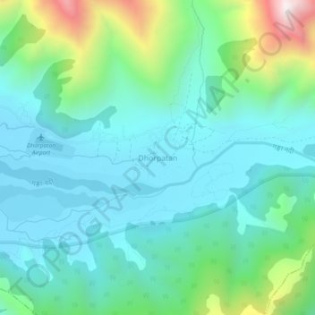
Name: Dhorpatan topographic map, elevation, terrain.
Location: Dhorpatan, Baglung, Gandaki Province, Nepal (28.47029 83.04727 28.51029 83.08727)
Average elevation: 3,082 m
Minimum elevation: 2,851 m
Maximum elevation: 3,882 m
Thank you for supporting this site ❤️
Make a donation
Make a donation
Other topographic maps
Click on a map to view its topography, its elevation and its terrain.