
Sonderhorst topographic map
Interactive map
Click on the map to display elevation.
About this map
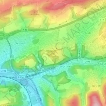
Name: Sonderhorst topographic map, elevation, terrain.
Average elevation: 209 m
Minimum elevation: 126 m
Maximum elevation: 328 m
Other topographic maps
Click on a map to view its topography, its elevation and its terrain.
Bueberg
Deutschland > Nordrhein-Westfalen > Märkischer Kreis > Iserlohn
Bueberg, Iserlohn, Märkischer Kreis, Nordrhein-Westfalen, 58762, Deutschland
Average elevation: 370 m