
Thank you for supporting this site ❤️
Make a donation
Make a donation
Senkobo topographic map
Click on the map to display elevation.
Thank you for supporting this site ❤️
Make a donation
Make a donation
About this map
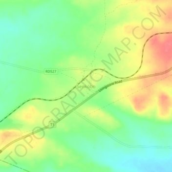
Name: Senkobo topographic map, elevation, terrain.
Location: Senkobo, Kazungula District, Southern Province, Zambia (-17.64655 25.92110 -17.60655 25.96110)
Average elevation: 1,103 m
Minimum elevation: 1,074 m
Maximum elevation: 1,139 m
Thank you for supporting this site ❤️
Make a donation
Make a donation
Other topographic maps
Click on a map to view its topography, its elevation and its terrain.